


August 28, 2008, - 10:11 am
Mitt Happens: Veep Candidate or Not, Romney Continues to Flip-Flop
By Debbie Schlussel
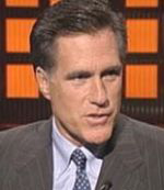
Remember how Mitt Romney won Michigan’s Republican Primary?
He promised millions in wasteful taxpayer loans and grants to the auto industry, while John McCain told Michigan’s laid off auto workers the truth: These jobs are not coming back.
Well, now, while he’s not-so-quietly running as a candidate for John McCain’s Veep selection, he’s flip-flopping.
In Denver to serve as McCain’s anti-Obama attack dog, he shied away from his previous position–apparently a lie–on government subsidies for the auto industry. That’s despite the fact that John McCain, formerly against the loans and grants, flip-flopped the other way and endorsed the aid, last week.
Michigan native Mitt Romney declined Tuesday to discuss his vice presidential hopes — or to support the loan guarantees for the auto industry that have become an increasingly important feature of the presidential campaign in battleground Michigan.
Romney, who won Michigan’s Jan. 15 primary in part on a pledge to help rebuild the domestic automakers, is widely viewed to be on John McCain’s short list of potential running mates. . . .
At a press conference and at a luncheon with reporters sponsored by the Christian Science Monitor, Romney repeatedly declined to comment on his vice presidential prospects. He criticized Obama as too inexperienced to be president, and stopped short of supporting the domestic auto industry’s call for federal loan guarantees to help it make the transition to more fuel-efficient vehicles.
McCain himself endorsed the guarantees last week, after having previously expressed skepticism.
“I think it’s important that we maintain an automotive sector in this country,” Romney said, adding that it was important to the economy and to protecting the defense industry’s base.
But asked about the loan guarantee proposal, he said: “What the nature of our support would be is something I anticipate would be developed over time.”
At a later news conference at the Republican National Committee’s “response center” in Denver, Romney acknowledged that McCain has supported the idea, but he does not.
“I did see Senator McCain has spoken out about being open” to the idea of guarantees, Romney said. . . .
Any aid, he said, is “something that should be a process of extensive negotiation, with a recognition that government should not bail everybody out, but if government is going to be involved, that it be something that involves all the parties, and there be giving from all the parties involved.”
For the record, I’m against those subsidies. While the money would greatly help my state of Michigan, where much of automotive America is based, and on which the Michigan economy unsmartly put all of its eggs, the money won’t bring the American auto jobs back. Instead, it will subsidize continued bloated multi-million dollar salaries and benefits packages for the incompetent CEOs that got Ford, GM, Chrysler, and the rest where they are now. And it will help subsidize the unwieldy health plans that cost $1,500 per each GM car to cover costs of Viagra for auto retirees.
But the fact that Romney ran on this and now admits he lied tells me he’s not exactly the best material for McCain’s choice of Vice Presidential running mate.
And, trust me, the Obama people will use this, big-time, in states like Michigan and Ohio, where auto workers are out of jobs.
Romney is as much a flip-flopper as John Kerry. No difference. And whaddya know, they’re both from the People’s Republic of Taxachusetts.
Like I always say, Mitt Happens . . .But Hopefully Not to the White House.

McCain flip-flops from a position you agreed with to one you don’t and you’re blasting Romney for flip-flopping the other way? You’re not fooling anyone, Debbie. You hate Romney because you think he’s anti-Israel. However, most conservatives want Romney on the ticket.
[NB: HUH? I NOTED THE MCCAIN FLIP-FLOP IN THIS VERY ENTRY. HELLO . . .? I’M NO HUGE FAN OF MCCAIN, EITHER. AS FOR ROMNEY, I DISLIKE HIM BECAUSE HE WON’T DENOUNCE HIS CHURCH’S $20 MILLION-PLUS BACKING OF A HAMAS CHARITY, BECAUSE HE SAID HE ADMIRES HEZBOLLAH, BECAUSE HE INSTITUTED STATIST, SOCIALIZED INSURANCE POLICIES, AND BECAUSE THE GUY IS A LIBERAL WHO FLIP-FLOPPED ON EVERY SINGLE ISSUE POSSIBLE. DS]
Norman Blitzer on August 28, 2008 at 11:32 am